
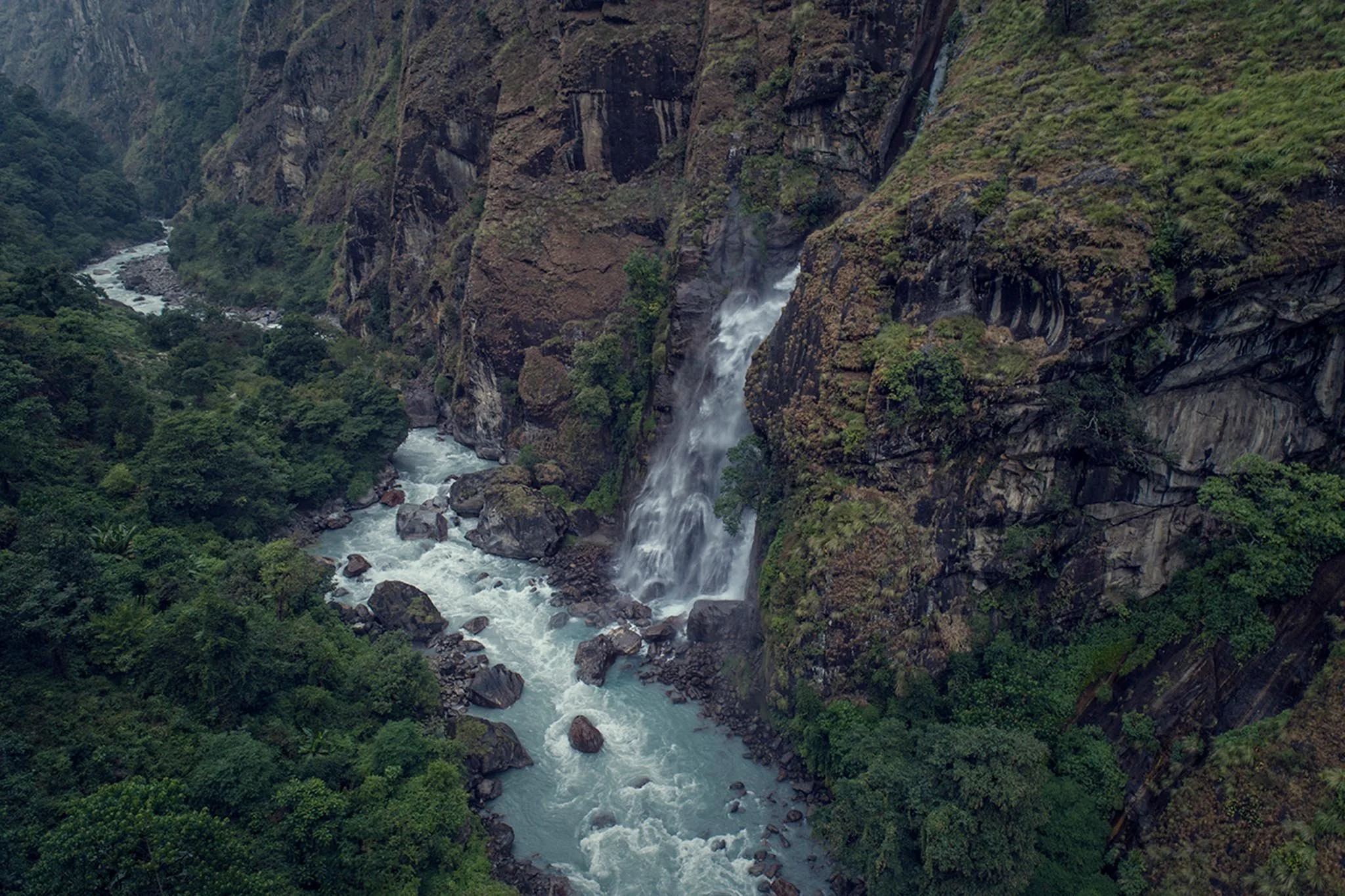
HIMALAYAN AERIAL PHOTOGRAPHY LEARNING EXPERIENCES IN NEPAL
Open door helicopter photography, professional aerial production and Himalayan visual exploration built around your objectives.
OPEN DOOR HIMALAYAN HELICOPTER PHOTOGRAPHY
A Professionally Planned Aerial Photography Experience in Nepal
6 DAYS · 1–2 PARTICIPANTS · PRIVATE EXPERIENCE
Three ways to experience the Himalayas from the air. Bespoke experiences can go further.
STANDARD EXPERIENCE
6 HELICOPTER FLIGHT HOURS INCLUDED
A focused Himalayan photographic experience combining aerial and ground photography, professional mentorship, field learning and portfolio development.
Total programme investment
US$44,000
IDEAL EXPERIENCE
10 HELICOPTER FLIGHT HOURS INCLUDED
More time to work across locations, light conditions, perspectives and photographic opportunities.
Our recommended experience.
Total programme investment
US$56,000
EXTENDED EXPERIENCE
16 HELICOPTER FLIGHT HOURS INCLUDED
Greater geographic diversity, more time to explore and more opportunities to build a broader Himalayan aerial portfolio.
Total programme investment
US$74,000
LOOKING FOR SOMETHING MUCH BIGGER?
Extended bespoke programmes can be developed around multiple regions, additional flight hours, research, environmental documentation, publications, exhibitions or long term visual projects.
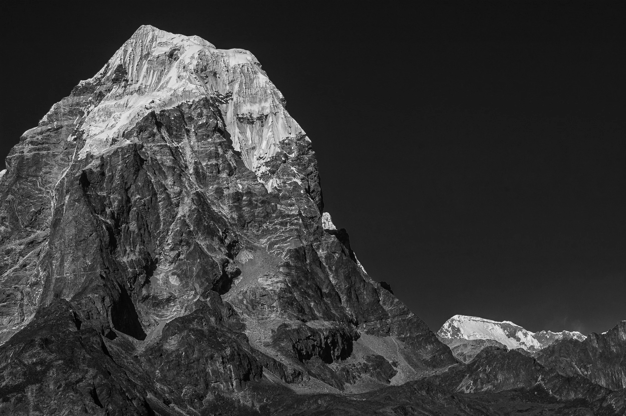
NOT A SIGHTSEEING FLIGHT
The Himalayas are not the destination. Your photograph is.
Normal helicopter operations follow established tourism routes and sightseeing objectives. This experience is built around your photographic goals, chosen subjects, locations, light, season and the images you want to create.
You are not simply flying over Nepal. You are planning to photograph it differently.
THE WINDOW DISAPPEARS
Open door helicopter photography changes what is possible.
With the helicopter door removed and no glass between you and the landscape, perspective, elevation, direction, movement and scale become part of the photographic decision.
The helicopter becomes part of the photographic process.
START WITH THE IMAGE
What do you want to create from the air?
A glacier. A river. A settlement. A climate story. A geological formation. A fine art series. A publication. A book. An exhibition.
We begin with your objective and work backwards through the geography, season, light, flight plan and production required to pursue it.
The photograph comes first. The helicopter follows.
BUILD THE FLIGHT AROUND THE OBJECTIVE
Every flight is planned around what you want to create.
Geography, season, weather, light, terrain, access, aircraft capability, flight time and operational feasibility all matter.
Every helicopter flight hour should have a photographic purpose.
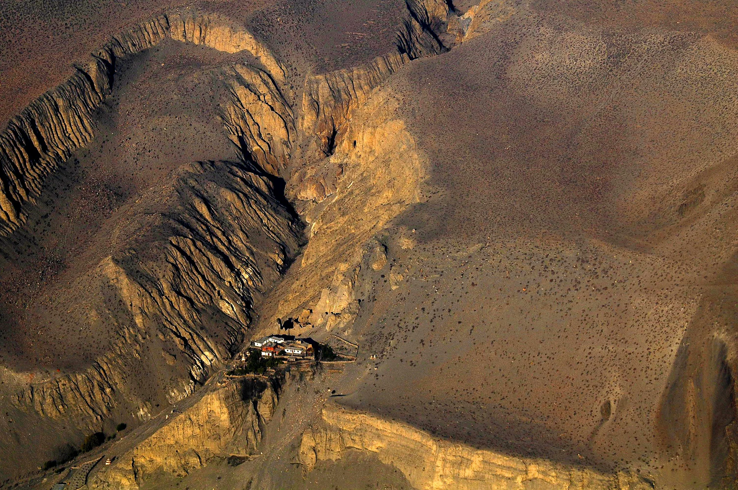
EAST TO WEST
Nepal becomes your aerial photographic field.
Everest and Khumbu. Annapurna. Manang. Mustang. Makalu Barun. Dolpa. Saipal. Api. Eastern Nepal. Western Nepal.
Different regions. Different light. Different stories.
WHAT THE LANDSCAPE DOES FROM ABOVE
You begin to see relationships, not just subjects.
A river becomes a system. A settlement becomes a pattern. A glacier becomes a living landscape. Roads, agriculture, forests, water and human movement begin to connect.
The aerial view changes how you understand the place.
THE PHOTOGRAPHER BECOMES PART OF THE FLIGHT
There is no pause button in the air.
Light changes. Clouds move. The aircraft moves. A landscape that looked perfect thirty seconds ago may already be gone.
You learn to anticipate rather than react.
Aerial photography rewards preparation, instinct and decisive thinking.
LEARN TO SEE FROM THE AIR
The skill is not simply looking down.
You learn to recognise scale, rhythm, geometry, texture, atmosphere, human presence, environmental change and the moments when they come together.
The view becomes a photographic language.
YOUR CORE MENTOR
Gautam Dhimal has been doing this since 2005.
His aerial work has evolved from film and digital photography into high resolution medium format work, helicopter missions, remote Himalayan production and long term environmental documentation.
He brings more than photographic technique.
He brings the field experience of making the operation work.
EXPERIENCE BEYOND THE CAMERA
You learn what happens before the photograph.
Location planning. Production logistics. Aviation coordination. Permissions. Weather. Equipment. Safety. Communication. Timing. Decision making.
The photograph is the visible result. The production behind it is the real lesson.
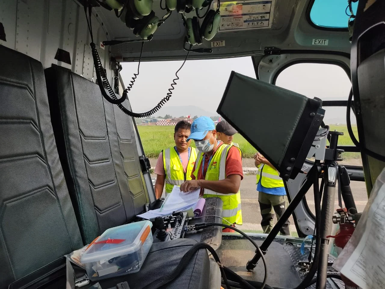
AVIATION IS A TEAM SPORT
The photographer is never the only specialist in the aircraft.
Depending on the operation, experienced pilots, aeronautical engineers, aviation personnel, production specialists and other supporting professionals contribute to the planning and execution.
You learn how photographers work with the people who make difficult photographs possible.
OPEN DOOR REQUIRES A SYSTEM
Freedom in the air depends on discipline on the ground.
Aircraft configuration, open door procedures, harnesses, equipment, movement, communication and crew coordination are considered before the flight.
Nothing important is improvised once the helicopter leaves the ground.
PERMISSIONS COME FIRST
Some of the most important work happens before you arrive at the helipad.
Applicable aviation permissions, operator requirements, documentation, route planning, geographic considerations and other formalities are addressed during programme preparation.
You concentrate on the image. We build the operation around it.
SAFETY BEFORE THE SHUTTER
Every photograph begins with a safety decision.
Participants receive appropriate aviation and field briefings covering movement, equipment, harnesses, communication, open door procedures and emergency requirements.
The aviation team retains final authority over operational safety.
If it is not safe, we do not make the photograph.
PREPARE FOR THE ENVIRONMENT
The Himalayas change quickly.
Altitude, cold, wind, weather, terrain, exposure and changing visibility all influence the experience.
Preparation includes appropriate clothing, equipment planning, physical readiness and environmental precautions.
The better prepared you are, the more completely you can concentrate on photography.
HEALTH, MEDICAL AND EMERGENCY PREPARATION
Remote photography requires more preparation than ordinary travel.
Programme planning considers the operating environment, altitude, access, communications and appropriate emergency arrangements.
Where required by the specific operation, medical support, oxygen, rescue and evacuation planning are assessed and coordinated with the relevant aviation and field professionals.
Safety planning begins long before the flight.
YOUR INSURANCE
You are responsible for protecting yourself and your equipment.
Participants must arrange appropriate travel, medical, emergency evacuation and personal equipment insurance suitable for the programme and its operating environment.
Insurance requirements are discussed during programme preparation.
Come prepared for the experience you are undertaking.
PLAN EARLY
Serious aerial photography cannot be built at the last minute.
We recommend beginning preparation at least one month before the programme.
That gives us time to understand your objectives, study seasonal conditions, assess locations, coordinate aviation requirements and build the operation properly.
Preparation turns flight hours into photographic opportunity.
DOCUMENT THE EXPERIENCE
The making of the work is part of the story.
Where included in the agreed programme, professional photography and video documentation can record preparation, briefings, aviation procedures, field work and the making of the images.
You return with more than the photographs you made.
WHAT YOU TAKE AWAY
Aerial photography. Field experience. A different way of seeing.
You leave with practical experience in helicopter based photography, aerial visual decision making, location planning, production thinking, safety awareness and Himalayan field work.
You also leave with photographs that can become the beginning of a more purposeful body of work.
The real takeaway is capability.
BUILD A BODY OF WORK
Not hundreds of photographs. Something with direction.
A strong aerial portfolio can move beyond individual mountain photographs into a coherent visual language.
Landscape. Climate. Water. Human settlement. Environment. Geology. Fine art.
A portfolio begins to become a proposition.
WHERE COULD THAT LEAD?
The photograph can open a much larger conversation.
Editorial assignments. Magazine features. Books. Documentary projects. Broadcast. Environmental campaigns. Tourism commissions. Conservation storytelling. Research collaborations. Fine art exhibitions. Commercial campaigns.
None is guaranteed.
But each becomes more possible when you have something meaningful to show.
WHO COULD COMMISSION THE WORK?
Think beyond the traditional photography client.
Publishers. Editors. Broadcasters. Tourism organisations. Hotels and destinations. Advertising agencies. Environmental organisations. Conservation groups. Research institutions. Universities. Foundations. Brands. Cultural institutions.
The wider your capability, the wider the market you can approach.
THE SAME SKILL. A DIFFERENT LANDSCAPE.
Take what you learn in Nepal home.
The same principles can apply to architecture, high rise buildings, monuments, cities, infrastructure, national parks, forests, agriculture, coastlines, rivers, cultural heritage and major development projects.
The landscape changes. The photographic thinking does not.
Your next aerial assignment could be much closer to home.
MAKE THE IMAGE WORK HARDER
Powerful aerial photographs can do more than look beautiful.
A single frame can sell a destination, reveal a development, document change, communicate climate, show infrastructure, tell a cultural story or make an organisation's work visible.
The stronger the photograph, the more conversations it can start.
CLIMATE FROM ABOVE
Aerial photography can reveal change that ground photography cannot.
Glaciers, snowlines, rivers, lakes, vegetation, agriculture and settlements can be understood as connected landscapes from above.
Gautam's ongoing The Vanishing Himalayas and Until We Act work uses aerial and ground photography to build a long term visual record of environmental and cultural change.
This is where photography can become archive, evidence and story.
THE VANISHING HIMALAYAS
One conversation. A much larger story.
The Vanishing Himalayas, by Gautam Dhimal, begins in the Everest and Khumbu region as a conversation about a changing Himalayan landscape, developed through aerial and ground photography.
The work is evolving toward a book, exhibition, scientific and research collaborations, community partnerships, education and outreach, creating a foundation for a much larger visual and environmental story.
A photograph can start a conversation. A body of work can help carry it forward.
UNTIL WE ACT
The bigger picture is still unfolding.
Until We Act, developed by Gautam Dhimal, builds on that conversation across the Hindu Kush Himalaya, spanning Afghanistan, Bangladesh, Bhutan, China, India, Myanmar, Nepal and Pakistan, with the potential to extend into other vulnerable landscapes around the world.
With production support from Location Nepal and the Gehendra Dhimal Foundation serving as custodian and knowledge resource, the larger vision connects aerial photography, ground expeditions, filmmaking, environmental documentation, human stories, research, education, publications and exhibitions.
This is what happens when photography becomes a long term mission.
THINK LIKE A COMMISSIONED PHOTOGRAPHER
Start asking who needs the photograph.
Who needs to communicate climate change?
Who needs to show a changing landscape?
Who needs a destination campaign?
Who needs a book?
Who needs an exhibition?
Who needs a documentary?
Who needs visual evidence?
That is where photography starts meeting economics.
AERIAL PHOTOGRAPHY IS A SPECIALIST CAPABILITY
And specialist capabilities travel.
The same thinking can apply to mountains, cities, coastlines, forests, infrastructure, agriculture, architecture, conservation areas and remote landscapes anywhere in the world.
Nepal becomes your training ground. The capability becomes yours.
THE DREAM IS BIGGER THAN NEPAL
Perhaps National Geographic is the dream. Perhaps something else.
Global editorial. International magazines. Documentary film. Major publishing. Fine art. Conservation. Climate communication. Commercial campaigns. Research. Your own long form project.
No programme can promise where your work will go.
But we can help you build work worth taking further.
WHO THIS IS FOR
For photographers who want more than another photography trip.
Advanced enthusiasts. Professional photographers. Visual artists. Documentary photographers. Environmental storytellers. Editorial photographers. Researchers. Creative professionals.
You should already understand photography and be comfortable working with your own equipment.
You bring the ambition. We build the environment to challenge it.
WHO THIS IS NOT FOR
If you simply want to see Everest from a helicopter, there are easier ways to do that.
This is not a sightseeing flight with a camera.
It is not a basic camera course.
It is not a luxury helicopter ride with photography added.
It is an intensive photographic experience built around serious objectives.
WHAT IS INCLUDED
The helicopter is only one component.
Professional photographic mentorship.
Aerial planning.
Applicable permissions and documentation.
Helicopter and aviation coordination.
Open door operational preparation.
Safety briefings and systems.
Geographic and seasonal planning.
Ground logistics and local coordination.
Supporting specialist expertise.
Programme photography and video documentation where included.
Participant materials and Certificate of Participation.
The investment covers the experience built around the flight hours.
WHAT IS NOT INCLUDED
Some things remain your responsibility.
International travel to and from Nepal, visa costs where applicable, personal travel expenses, personal medical and travel insurance, equipment insurance and personal photography equipment are not included.
Any requirements outside the agreed programme are discussed before implementation.
You know what you are investing in before you fly.
YOUR EXPERIENCE. YOUR OBJECTIVE.
Choose the scale that matches what you want to create.
STANDARD EXPERIENCE
6 HELICOPTER FLIGHT HOURS INCLUDED
Total programme investment
US$44,000
A focused six day experience for a defined Himalayan photographic objective.
IDEAL EXPERIENCE
10 HELICOPTER FLIGHT HOURS INCLUDED
Total programme investment
US$56,000
Our recommended experience for greater geographic, photographic and creative flexibility.
For an ideal photographic experience, we recommend 10 total helicopter flight hours.
EXTENDED EXPERIENCE
16 HELICOPTER FLIGHT HOURS INCLUDED
Total programme investment
US$74,000
For participants who want to explore further and build a broader Himalayan aerial portfolio.
For an extended experience, 16 total helicopter flight hours allow considerably more time to explore different locations, conditions and perspectives.
SOMETHING MUCH BIGGER?
Build the aerial project around the mission.
A bespoke programme can combine additional flight hours, multiple Himalayan regions, broader geographic coverage, research, environmental documentation, visual archives, publications, exhibitions or long term projects.
The objective determines the scale.
HOW THE PROCESS BEGINS
Your enquiry starts the production process.
Tell us what you want to photograph, your preferred dates, your experience level and what you hope to create.
We discuss the objective, assess the geography and season, consider aviation and safety requirements, then build the programme around what is realistically achievable.
The flight is the final stage of the preparation.
FREQUENTLY ASKED QUESTIONS
The things you will probably want to know before you ask.
Is this a helicopter sightseeing tour?
No. It is a professionally planned aerial photography experience built around specific photographic, creative, research or documentation objectives.
Is this available elsewhere in Nepal?
This particular open door Himalayan photography experience is developed and operated through Location Nepal and Gautam Dhimal's photographic and production expertise.
Can I simply charter a helicopter myself?
You can arrange a normal charter or sightseeing flight. This programme is different because the aviation operation is built around a serious photographic objective.
Why is open door photography different?
Removing the helicopter door eliminates the glass barrier and changes the possibilities for perspective, composition, movement, equipment and visual access. It also introduces additional operational and safety requirements.
Can we fly outside normal tourism routes?
Potentially, subject to applicable aviation requirements, permissions, aircraft capability, weather, safety and operational feasibility.
Can I choose exactly where we fly?
You define your photographic objectives and geographic interests. Final flight planning depends on aviation, weather, access, safety and operational requirements.
Can we photograph Everest?
Everest and the Khumbu region can be considered where appropriate, subject to operational feasibility and applicable requirements.
Can we photograph Annapurna, Manang, Mustang or Dolpa?
These and other Himalayan regions can be considered according to the objective, season, aircraft, permissions, weather and operational feasibility.
Can the programme cover multiple regions?
Yes. The extended and bespoke options provide greater opportunity for geographic diversity.
How many participants can join?
The private programme is designed for one or two participants.
Who leads the photography?
Gautam Dhimal is the core photographic and production mentor, supported by appropriate aviation and specialist professionals according to the operation.
Are pilots and aviation specialists involved?
Yes. Experienced aviation professionals contribute according to the aircraft, route, objectives and operational requirements.
Are harnesses and safety systems provided?
Appropriate harnesses and safety systems form part of the operational planning where required and approved for the specific flight.
Is oxygen available?
High altitude considerations are assessed during programme preparation. Where required by the operating environment and aviation plan, appropriate oxygen arrangements are considered.
What happens if the weather changes?
The flight plan may be adjusted, delayed, relocated or cancelled when weather or operational conditions make the planned activity unsafe or impractical.
Is personal insurance included?
No. Participants must arrange appropriate travel, medical, emergency evacuation and equipment insurance for the programme.
Will the experience be photographed and filmed?
Where included in the agreed programme, professional behind the scenes photography and video documentation can record the preparation, operation and photographic process.
Do I need to be a professional photographer?
No. But you should already understand your camera and the fundamentals of photography. This is not a beginner camera course.
What equipment should I bring?
Equipment guidance is provided during preparation according to your objectives, flight plan and photographic approach.
Can this become a research project?
Yes. Bespoke programmes can be developed around environmental documentation, visual archives, research, publication and educational objectives.
Can this become a book or exhibition?
It can become the foundation for one. Publication, exhibition and fine art outcomes are possibilities, not guaranteed results.
Can this lead to professional commissions?
The programme does not guarantee commissions. It is designed to develop a specialised photographic capability and body of work that participants can take into editorial, commercial, environmental, documentary, publishing and other professional markets.
What happens after I select an experience?
Your enquiry begins the planning process. We discuss your objectives and dates, assess feasibility and develop the programme before formal booking.
OPEN DOOR HIMALAYAN HELICOPTER PHOTOGRAPHY
A Professionally Planned Aerial Photography Experience in Nepal
6 DAYS · 1–2 PARTICIPANTS · PRIVATE EXPERIENCE
6 HELICOPTER FLIGHT HOURS · US$44,000
10 HELICOPTER FLIGHT HOURS · US$56,000
16 HELICOPTER FLIGHT HOURS · US$74,000
READY? LET'S START.
Where do you want your photography to take you next?
The Himalayas are waiting. Your photograph is the reason to go.